In the field of construction site safety, geolocation of lone workers is emerging as an invaluable tool, redefining employee protection standards. But how does this technology actually work? How can it guarantee the safety of workers operating in potentially risky environments?
In this article, we’ll dive into the mechanics of lone worker geolocation, exploring how it works in depth and highlighting the benefits it offers in terms of safety, resource management and operational efficiency. You’ll discover how Wirepas Mesh technology is positioned at the heart of modern strategies to improve worker safety on construction sites.
What is lone worker geolocation?
Geolocation of lone workers on construction sites refers to the use of location technologies to track and identify the position of workers operating in potentially isolated or hazardous environments. The aim is to ensure their safety by enabling rapid intervention in the event of an emergency, and to optimize resource management on the site.
The indoor geolocation of people presents various constraints and challenges, often more complex than outdoor geolocation due to structural obstacles such as walls, ceilings and metal structures. Floor management, for example, is as essential as it is technically complex to manage to ensure the best possible accuracy.
The confidentiality of position information is also an important consideration. Indeed, geolocation solutions for lone workers must be designed to comply with local standards and laws. In all cases, transparency is essential. Employers must inform workers of the implementation of such a solution, its purpose (in this case, their safety), the type of data collected and how long it will be retained. Data collection must be limited to the minimum necessary, and the employer must obtain the explicit consent of its employees.
What is the purpose of geolocation for lone workers?
The geolocation of lone workers is of crucial importance to resource management and safety on construction sites, especially when subcontractors are involved. This technology makes it possible to track in real time the position of workers in potentially dangerous environments, facilitating team coordination and efficient human resources management.
In the event of an emergency or evacuation plan, geolocation enables alerts to be sent remotely, ensuring a rapid, organized response. What’s more, geolocation enhances site safety by limiting access to authorized personnel, and ensuring that safe zones are respected.
By integrating lone worker geolocation into operational management, companies can not only improve safety, but also optimize their processes, ensuring safe working conditions and efficient coordination of teams on site.
How does geolocation of lone workers work?
There are various wireless communication technologies on the market for geolocating lone workers, but each has its own advantages and disadvantages. In this article, we focus on the Wirepas Mesh technology used on many construction sites.
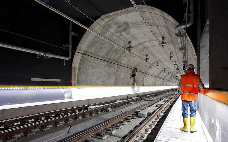
Find out how the SNCF used geolocation to secure the RER C construction site in Paris.

Wirepas Mesh wireless geolocation technology
To overcome the inaccuracy of satellite geolocation (GPS) in indoor or underground environments, the Wirepas communication technology-based geolocation solution relies on an intelligent system that creates an invisible mesh.
To operate, this technology relies on an ultra-lightweight IoT infrastructure made up of connected tags called location tags and industrial gateways. Certain location tags, fixed at regular intervals on the walls, will create the intelligent mesh network where all connected objects communicate with each other. The position of these fixed tags will be used as a reference to calculate the location of the mobile tags with which operators will be equipped. To achieve this, the mobile tags will regularly emit an RSSI signal, which will be received by the fixed tags in the proximity.
The information is transmitted through the mesh network to the nearest gateway, which centralizes the data and transfers it to the customer’s servers or cloud. It is here, on the so-called Back-End, that the position of the various mobile tags is calculated. To do this, Wirepas has developed a tool called the Wirepas Positioning Engine (WPE), which is capable of calculating the position of mobile tags based on the strength of the signal emitted by them. On a 2D map, the tool provides the position, to within 5m, of the various mobile tags. It can also dissociate floors, if any. The data can then be viewed on a business web application, which we’ll talk about later in this article.
The location tag, a true PPE
Let’s take a closer look at the location tag. This connected object acts as genuine PPE (personal protective equipment) for operators working on construction sites. Battery-powered, it can be attached to a construction helmet or worn as a badge on a belt.
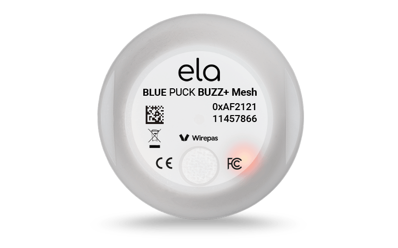
Some tags, like those from ELA Innovation, are equipped with an LED and a buzzer to automatically alert the operator in the event of danger.
The NFC chip embedded in these mobile tags makes them compatible with access controllers on the market. As a result, operators don’t need an additional badge to gain access to the site. When they arrive at the security gate, their badge is automatically detected.
Industrial gateways to centralize data
The Gateway is the connecting element between the inside and the outside. This box is the only element requiring an electrical connection (battery-powered). As the Gateway’s role is to transfer data between the mesh network and the server/cloud, it requires Ethernet, WIFI or 3G/4G connectivity. On average, a gateway can cover 10 floors. In the case of a tunnel, we recommend installing a Gateway every kilometer.
The business platform for resource visualization and management
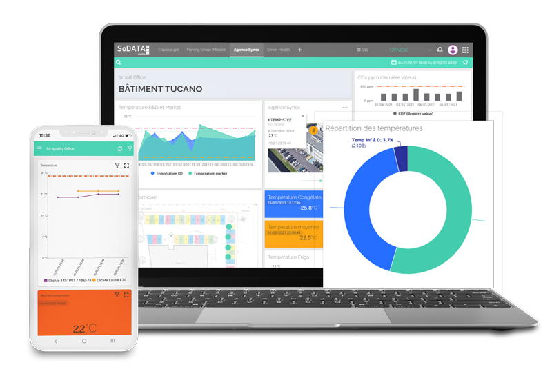
Although it is possible, via Wirepas’ WPE tool, to visualize the position of location tags on a plan, the use of a business web platform, such as Synox’s SoDataViz platform, is essential for optimal use and perfectly adapted to the construction industry.
The web platform is accessible 24/7 from any device (PC, tablet or mobile). It generally offers different levels of authorization depending on user profiles (site manager, team leaders, operators, subcontractors, etc.). The site manager can enter the site plan and manage his/her network of location tags (fixed and mobile) and gateways.
The platform is a project management tool that enables you to manage the allocation of human and material resources according to schedule and requirements, and thus avoid delays.
On a day-to-day basis, this application will enable the site manager to locate and count the workforce by zone, identify isolated workers and remotely trigger alerts in the event of evacuation.
In this last case, all the fixed tags on the network will flash, and the mobile tags carried by the operators on site will emit an audible alert (buzzer at 80 decibels), as well as a visual alert (flashing high-brightness LED). In the event of an incident, this type of platform will be a vital help to the emergency services, enabling them to quickly locate people in difficulty.
Advantages of geolocation for lone workers with Wirepas technology?
Thanks to its lightweight infrastructure, based on battery-powered wireless location tags, this geolocation solution for isolated workers is ultra-simple to deploy. It’s also scalable, so it can keep up with the progress of the worksite. Network extension requires no specific network skills, and can be completed in less than an hour.
Wirepas Mesh technology offers geolocation accuracy to within 5m, which is more than sufficient for most indoor applications. Its GPS-free operation enables this communication technology to be used in underground environments such as tunnels. Last but not least, this type of IoT infrastructure offers the possibility of adding to the same network the tracking and inventory of tools and site equipment, as well as integrating environmental sensors such as temperature, humidity or presence sensors.
“I had already experienced other solutions and was pleased to find that the ELA Innovation solution was particularly easy to use. We’re happy to keep the solution.”
E. GALAND SNCF Project Manager
Would you like to find out more about our lone worker geolocation solution? Our IoT experts are here to guide you.